
After biding our time in Bermagui, we finally made the trip south to Victorian waters. And we saw our first Victorian numberplate on Gabo Island!
This blog describes our trip from Bermagui into Lakes Entrance (the Gippsland Lakes) and we certainly had some interesting experiences.
But first, I’ll explain how I planned this passage and here’s an image of the area in case you’re not familiar with these locations.

Passage planning
I wasn’t concerned about the passage from Bermagui to Eden, so I didn’t figure this trip into the following plans. Bermi to Eden was relatively straightforward, being about 43 nautical miles (NM) and taking six hours. The only thing to be mindful of was it’s a bar crossing leaving Bermagui, so to time our departure close to the top of the incoming tide. Then, on arriving at Eden, we had plenty of time, and provisions, to wait for the next weather window to get to Lakes Entrance.
Below were my options for getting from Eden in New South Wales to Lakes Entrance on the south coast of Victoria.
Option 1 - One hop going straight through (pretty much the image above)
Eden to Lakes Entrance, 130NM, 17 hours.
I pretty quickly ruled this out option because:
- We’re not keen to travel at night unless really necessary, particularly along costal areas we’re unfamiliar with.
- We had time, and plenty of provisions, to wait in Eden for a better window opening up for later during the week.
Option 2 - Two hops with one overnight anchorage
Plan A:
1. Eden to Point Hicks, 70NM, 9.5 hours.
2. Point Hicks to Lakes Entrance, 60NM, 8 hours.
Plan B:
1. Eden to Gabo Island, 37NM, 5 hours.
2. Gabo Island to Lakes Entrance, 97NM, 13 hours.
Either passage would be achievable especially if we only had a two-day weather window and no signs of improvement. But of the two, Plan A was my preference due to having two “more balanced” passages regarding travel time. It would be a bit easier to time our departure and arrival times during daylight hours. And it provided an opportunity to explore Gabo Island.
Option 3 - Three hops with two overnight anchorages
1. Eden to Gabo Island, 37NM, 5 hours
2. Gabo Island to Point Hicks, 36NM, 5 hours
3. Point Hicks to Lakes Entrance, 62NM, 8 hours
This was my favourite option because it would mean shorter days of travel. It was also an opportunity to explore Gabo Island, and to see some of the coastline closer up. But, this meant I needed a three-day weather window with the best conditions being for our arrival at Lakes Entrance bar.
As part of the passage plan, I then factored in the weather conditions and information I’d gathered about the Lakes Entrance Bar.
Watching the weather
The challenge was getting a three-day weather window for our trip from Eden to Lakes Entrance, my preferred option, or less desirable, a two-day weather window. The main weather applications I use are Windy, which provides a more distant and detailed view of what’s happening, Seabreeze, which provides a 7-day outlook and I really just use to cross-check the other details, and the BOM METEYE website, which is generally accurate for the next three days. (And sometimes I also look at PredictWind!)
I wanted to find the “best” day regarding weather conditions for arriving at Lakes Entrance and then work backwards. When I started checking, it looked like we could cross the Lakes Entrance bar on Wednesday 8 November so this meant leaving Eden on Monday 6 November.
Here are some screenshots from Windy with explanations if you put focus on the pictures. But when I compared with Meteye, the predicted swell conditions of 2-3m on Monday put me off.
After checking weather apps again, and specifically Meteye, it looked like we could arrive at Lakes Entrance Thursday 9 November in excellent conditions. This would mean leaving Eden on Tuesday 7 November and while the first section from Eden to Gabo was a bit more rolly than we normally like, we could put up with this if the weather remained as predicted for the subsequent days. You’ll also notice that once we rounded the corner, there was less swell. Once again, you’ll see more information if you put focus on the pictures.
Lakes Entrance Bar
I’d been told on a number of occasions that the bar at Lakes Entrance can be quite treacherous, and in fact has claimed a number of lives. But this year we’ve been gaining more experience crossing bars in NSW including Tweed Heads, Iluka/Yamba, Port Macquarie, Camden Haven, Forster, Swansea, Bateman’s Bay and Bermagui. And what we’ve learnt is patience – waiting for the right conditions and not travelling to a timetable.
A lot of information about Lakes Entrance bar is provided by Gippsland Ports, including a couple of cameras set up to show the conditions at the bar and details taken from a directional waverider buoy that measures wave height, period, direction, and water surface temperature.
You can take a look yourself at the information provided on the Gippsland Ports website.
Our friends on MV Singapore also highlighted the importance of being aware of predicted and measured tide water levels and current speed, which I hadn’t considered, so I started looking at that information as well.
So armed with weather and bar information, we left Eden on Tuesday 7 November.

Overview of our route
This video* shows the route we travelled. But I strongly recommend you look at the information below to read about some of our experiences, particularly when anchoring at Gabo Island, which at the 38 second mark you’ll see us moving around a bit. And what happened later could also explain the Optus outage!!
*There’s no sound with this video because the music choices with “Relive” are limited and I really don’t like any of them. Subsequent videos do have sound, mainly of the wind, or of me speaking!
Bermagui to Eden
On Saturday 4 November we left Bermagui for Eden. We saw a few whales as we headed south and also had a bit of a storm come through. It was a little bumpy on the water as you’ll see in the video, but not too bad, and about six hours later we anchored in East Boyd Bay (Eden) behind the naval wharf. It was a great, protected anchorage for any south/south easterly conditions and we took the opportunity to use the tender and motor around to Kiah Inlet for a look.
At around the 8 second mark, you might spot a whale spout in the water and then its tale slap around 15 seconds (on the horizon)!
But in this location you need to be aware of naval traffic movement. If a naval vessel is berthed here, there’s a 460m clearance zone meaning if we didn’t keep an eye on what’s happening we could be stuck in the bay – frustrating if we had a weather window to leave! As it turns out, Marine Rescue Eden broadcasts on VHF 16 when a ship is due in port. There was one arriving about 0700 Tuesday 7 November for the day, so we headed over to Snug Cove on Monday morning.
We saw the cruise ship Majestic Princess anchored near Snug Cove, with tenders regularly ferrying passengers to and from the dock. We also took the tender around Snug Cove and to the beautiful sandy beach.
Eden to Gabo Island
Early Tuesday 7 November, we headed to Gabo Island. And while the conditions weren’t exactly what we preferred, remember we were focusing on conditions for the Lakes Entrance bar crossing.
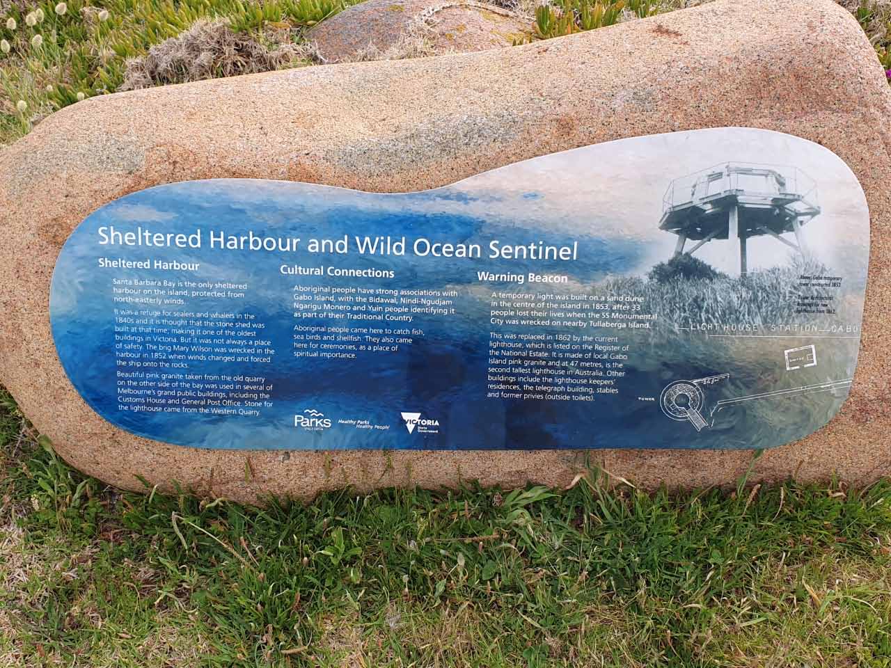
Gabo Island is located at the south-eastern corner of Australia, where the Bass Strait and Tasman Sea meet.
It’s also the largest breeding colony of Little Penguins in Victoria (unfortunately we didn’t get to see any). Shearwaters (mutton birds) also breed on the island.
And at about 10:30am on 7/11/2023 we crossed into Victoria Waters!
What happened when we anchored at Gabo Island!
We arrived at Santa Barbara Bay, Gabo Island and dropped the anchor in what seemed like a good spot. Even though the anchor was holding, I felt we were a bit close to shore. OK, we were about 80m off the rocks, but I still wasn’t comfortable due to strong winds. So we decided to move and that’s when some of the fun started! The windlass, that raises the anchor, was straining a lot and taken ages. With the strong winds I was at the helm making sure we didn’t get blown back too close to the shore. Finally, the anchor came up together with about 4m of extremely thick and encrusted chain. So thick that it almost obscured our rather sizable Manson Supreme anchor itself and way too heavy to lift off. Robert figured out how to get the anchor free of the chain, by looping a line around it and securing the line to a cleat, then lowering the anchor. One free, he released one end of the line and the chain fell about 11m into the water. Phew, we could finally move to a different location. The anchor path image below also shows you how much we were moving around while sorting this out!
But it seems that lightening does strike twice. The next day when we raised the anchor, once again the windlass was straining. This time we snagged a lengthy cable. Could this have been the cause of the Optus outage? (only joking). I managed to get a couple of photos and as luck would have it, suddenly the anchor started to spin around and the cable slid off leaving us free to carry on!
*I marked the approximate locations on Navionics to caution others who might anchor where we did.
Exploring Gabo Island
Despite it still being a bit windy Wednesday morning, we wanted to take the opportunity to explore some of Gabo Island, so we took the tender to shore. I’ll let the photos tell the story, but I will say the return trip to the boat was extremely bumpy and I got soaked!
And the wind persisted and even picked up, as you can see/hear from this video!
Gabo Island to Point Hicks
Next stop was to go from Gabo Island to Point Hicks and stay overnight. We had awoken to a lovely sunrise and enjoyed exploring Gabo before we left. When we arrived at Point Hicks, the weather conditions were perfect and the water colours amazing. We enjoyed a pleasant evening/night, although around 2am we did start rolling a little. But, when we awoke, we discovered that 1000s of flies (maybe sandflies) covered the decks, so I spent some time hosing them off with our saltwater pump. I should have taken more photos because they were in quantities I’ve never seen before (and quite gross). In fact, it took days to get rid of most of them!
Point Hicks to Lakes Entrance
Thursday finally arrived and after spending about an hour hosing dead bugs off everything, we lifted the anchor and started our third hop to Lakes Entrance. Naturally I’d checked weather conditions regularly along the way and was relieved to see everything was pretty much the same!
In this video you’ll get an idea of our conditions. However, shortly after recording this, we experienced some thick fog and then rain. I guess it was indicative that in Victoria you can experience four seasons in one day!
I was both excited and nervous as we approached the bar, and because I wanted to take photos, Robert took the helm. And to be completely honest, the greatest degree of difficulty in the crossing was avoiding the seals that were floating in the waters just across the bar!
Once across, we decided to go upstream and check out the public moorings, but they’re not like what we’re used to in NSW, so we figured we’d anchor instead. We then enjoyed a bottle of champagne to celebrate completing this part of our adventure (and Robert’s birthday).
Where to next?
We’re going to enjoy the calm waters of the lakes and explore them for the next couple of weeks. Then we’ll slowly make our way to Melbourne. And if you’re wondering, are we still going to Tasmania, yes we still are probably in February 2024.
11 Responses
Love the photo of Poseidon in front of the cruise ship, and also the photo of those pesky but cute seals in the Gippsland Lake 😊
I’m starting to feel the cold in my bones just watching 😜🥶
Another great blog. Beautiful photos in parts of the coast we have never travelled.
Take care on the next part of the journey.
Great post Pam, we will keep it handy for next year. We will probably see you in Tasmania if not before in Port Philip. Currently in Port Lincoln SA, Wasn’t the Great Australian Bight fun?!. Departing tomorrow for a slow trip to Adelaide via Kangaroo Island. Taking a two week break at a marina before heading to Port Philip for Christmas and New Year. Stay Safe.
Great story Pam!
Amazing the information available now to help plan a passage. The weather info seems pretty accurate.
Hope you enjoy the Lakes! We spent many happy times on our trailer sailer. One of our favourite places Boxes Creek which you should be able to manage with plenty of water under you keel if you stick to the eastern shore. Once inside there is a sandy beach off your port bow. It drops off qhite steeply and I think you should be able to nose onto the beach safely. Anchoring can be a bit snaggy, tho I suspect your winch could deal with anything down there. We used to have excellent counter lunches at the Metung pub which has excellent berthing facilities.
You’ve probably found already that the Gippsland Port Authority is a mine of information and while the online maps are no longer available to download the webmap:
https://gippsports.maps.arcgis.com/apps/webappviewer/index.html?id=b0359988ca3241729e331f284f44587c¢er=147.6,-37.99&level=11
is kept up to date and very useful.
Hope you enjoy your stay! (with beautiful weather. Always helps!)
Thanks for the photos of Gabo Island. All lighthouses have a history of disasters and isolation and Gabo certainly has its share. Also, good to hear that you came smoothly in to Lakes Entrance. I have seen it looking really treacherous at times, so you did well, only having to dodge the seals!
Wow, getting into the “four seasons in one day” territory. Enjoy.
Great blog this one. I like the fact you can tap on each photo and get the rest in each section. Must take you many hours and days to update & complete . I take my hat off to you both. Living the dream , and tremendous attitude, a real in-depth sight into your journey so well written with all the tech data. Love you Coz. Malcsx
Love the more wild and rugged coastline with fewer people.
All we can say is wow! You are both amazing.
Enjoy and stay safe.
Rob & chicka
Welcome to Victoria, good work both of you!
Hmmm that cable? Optus ??? Hmmm
Only joking, I am with Telstra anyway.
Enjoy Lakes entrance x